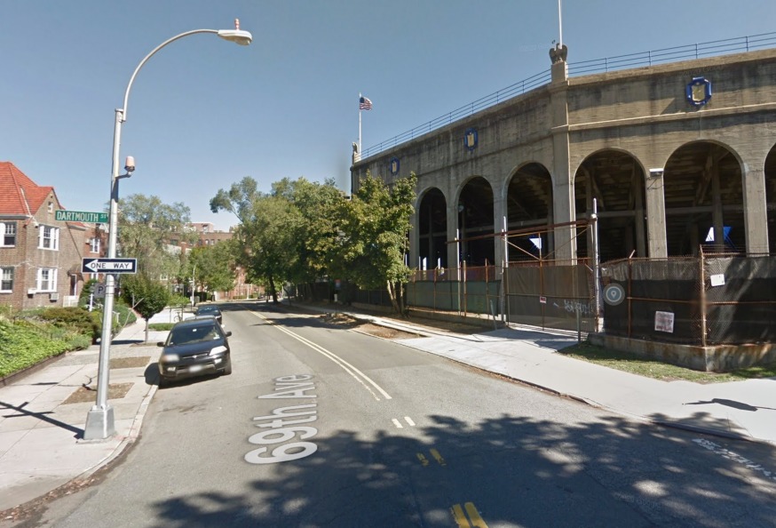
Elected officials are requesting the DOT to study 69th Avenue between Burns Street and Metropolitan Avenue (GMaps)
Aug, 5, 2022 By Christian Murray
A number of elected officials are calling on the Department of Transportation to conduct a study of 69th Avenue in Forest Hills and install a number of traffic controls.
The call comes from four legislators—Congressmember Grace Meng, State Sen. Joseph Addabbo, Assemblymember Andrew Hevesi and Councilmember Lynn Schulman—in the wake of a crash on 69th Avenue between Fleet Street and Groton Street on July 20 when an SUV had a head on collision with a bus.
The four legislators, joined by Community Board 6 chair Heather E. Beers-Dimitriadis, penned a letter to DOT Commissioner Ydanis Rodriguez on July 27 calling on the agency to survey 69th Avenue between Burns Street and Metropolitan Avenue.
“We write today to alert you of a safety concern that has been brought to our offices’ attention by multiple constituents, and to respectfully request guidance from your administration on how to proceed to ensure the wellbeing of commuters and pedestrians in our respective districts.”
The elected officials and their staff conducted a site visit of 69th Avenue soon after the crash. They said they noticed a general lack of traffic controls on the avenue, as well as a blind curve where the road narrows on 69th Avenue by Dartmouth Street. They say the blind curve creates an additional hazard especially with the Q23 bus line that is currently routed along 69th Avenue.
“We respectfully request that the New York City Department of Transportation, which receives funding in part from the federal government, survey the area and install traffic controls that may include, but not be limited to four-way stop signs, crosswalks, and speed bumps along 69th Avenue between Burns St. and Metropolitan — controls that already exist on the corridor between P.S. 144 and Our Lady of Mercy,” the lawmakers wrote.
The officials said that the road conditions were particularly concerning since the area is home to young families, small businesses, and schools—and is also a place where many residents park their vehicles.
They said that 69th Avenue is often treated like a thruway—something that it is not. “It’s a highly residential neighborhood and we need to make sure drivers treat it as such.”
The legislators have called on the DOT to tap into the Safe Streets and Roads for All grant program that was recently established by the federal government as part of the $1.2 trillion Infrastructure Investment and Jobs Act. The new program provides $6 billion for projects that aim to reduce road deaths and serious injuries.

Featured Events


4 Comments
Control the concerts!
Which local politician lives in this area? That is the only reason why it is seeing the attention it is because other intersections and streets have been ignored by CB6 and DOT but somehow this one instantly gets attention.
If a politician lived in the area, the concerts would be better regulated. I’m happy they’re doing something about the intersection but what’s an even bigger problem is the lack of oversight of concerts. This selfish promoter (Mike Luba) is killing the surrounding neighborhood and our quality of life.
Completely agree. The bill of goods we were sold when they were initially bringing the concerts to us are completely different than what we have now.